Welcome to Hemlock and Canadice Lakes!
Barns Businesses Cemeteries Churches Clinton & Sullivan Columns Communities Documents Events Time Line Fairs & Festivals Farm & Garden Hiking Homesteads Lake Cottages Lake Scenes Landscapes Library News Articles Old Maps Old Roads & Bridges Organizations People Photo Gallery Podcasts Railroad Reservoir Schools State Forest Veterans Videos
|
Old Roads & Bridges |
|
|
Click any image to enlarge. |
Images are shown alphabetically by town. |
|
Canadice |
|
1 |
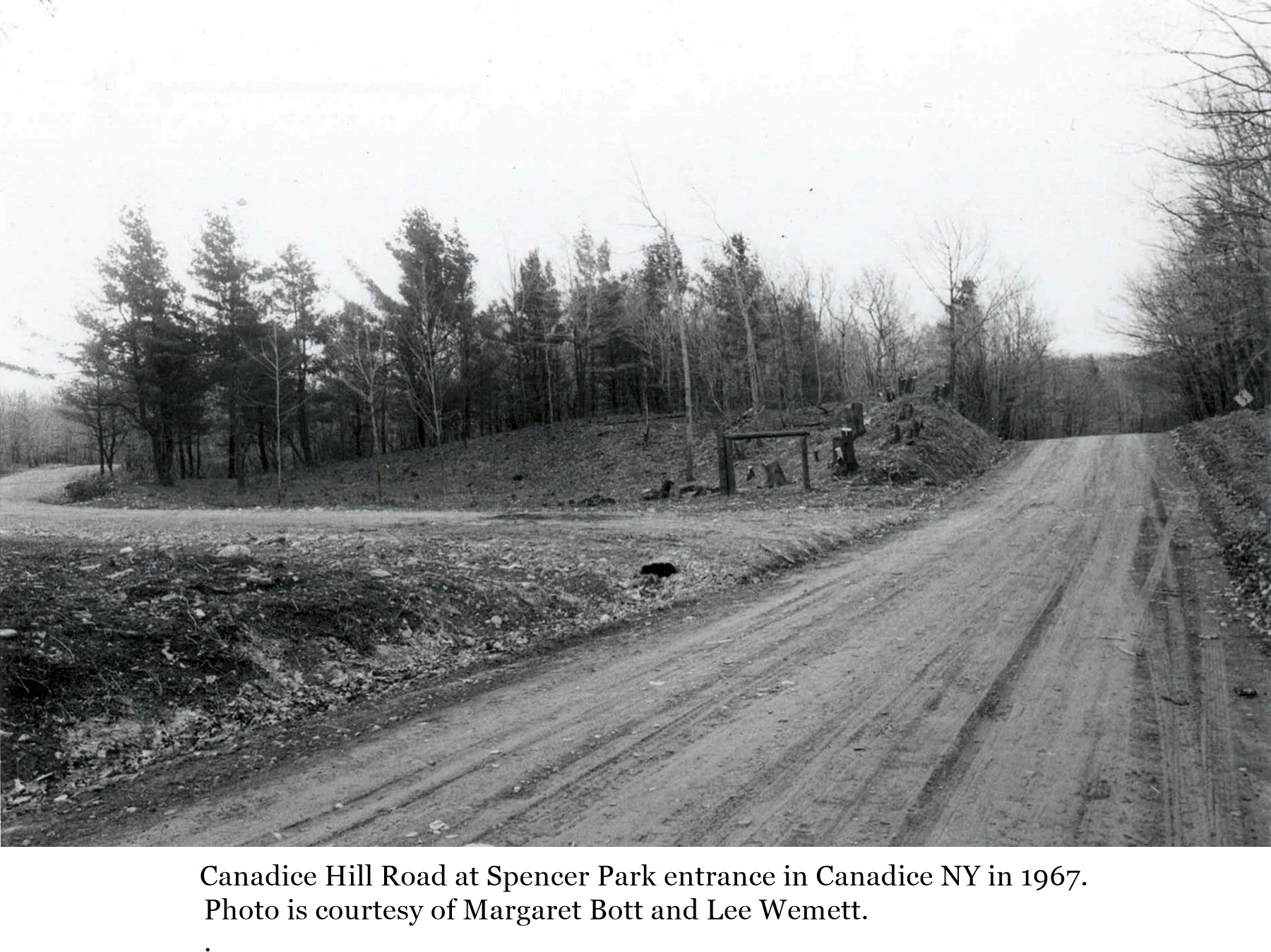
A photo of Canadice Hill road at the entrance to Spencer Park in Canadice NY in 1967. The view is looking south along Canadice Hill road. This photo courtesy of the Canadice Historical Society and Wemett.net. Click the image to enlarge. |
|
2 |
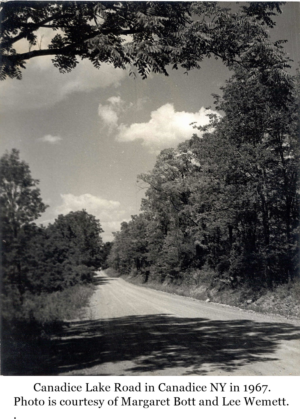
A photo of Canadice Lake road in Canadice NY in 1967. The exact location on the road is unknown. This photo courtesy of the Canadice Historical Society and Wemett.net. Click the image to enlarge. |
|
Conesus |
|
Images of Old Roads and Bridges of Conesus coming soon. |
|
|
|
|
Dixon Hollow |
|
3 |
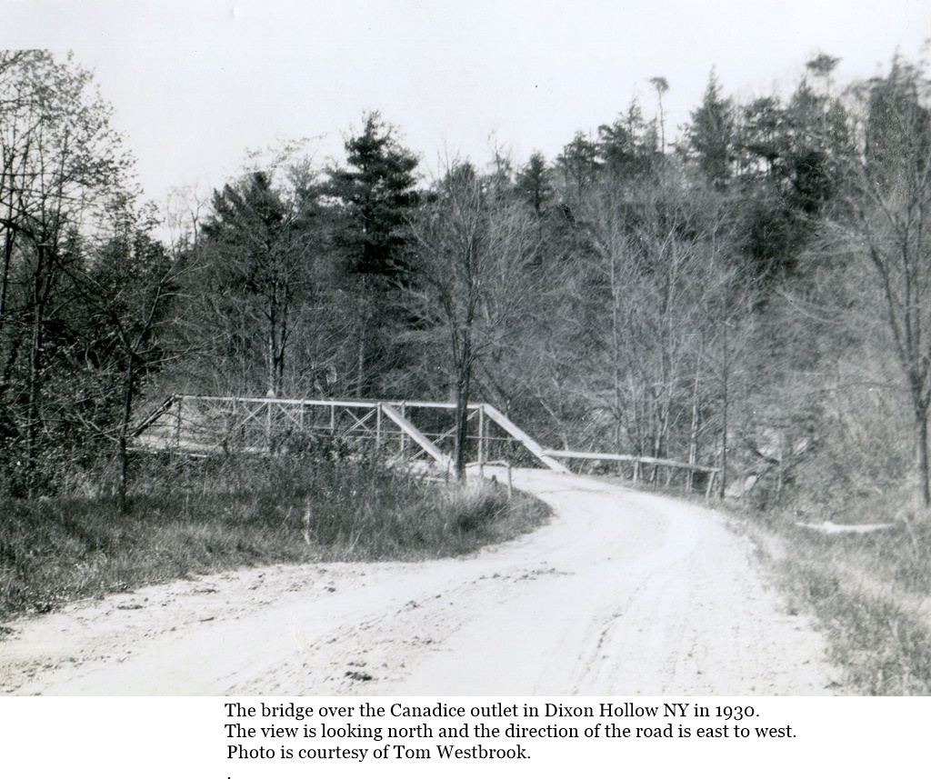
A photo of the bridge over the Canadice outlet in Dixon Hollow NY in 1930. This is the second bridge going east into the hamlet of Dixon Hollow from Hemlock NY. The bridge was removed and the road closed circa 1946 when the City of Rochester acquired the land for its water reservoir. The land was originally owned by Mrs. Grace Welch and Elijha Skidmore. This view is looking north and the direction of travel over the bridge is east to west. This photo courtesy of Tom Westbrook. Click the image to enlarge. |
|
4 |
A photo of the Dixon Hollow road and bridge in 1946. This is the first bridge going east into the hamlet of Dixon Hollow from Hemlock NY. The bridge was removed and the road closed when the City of Rochester acquired the land for its water reservoir. The land was originally owned by Mrs. Grace Welch and Elijha Skidmore. This view is looking east and the direction of travel over the bridge is west to east. This photo courtesy of Andrea and Bob Deats. Click the image to enlarge. |

|
Hemlock |
|
5 |
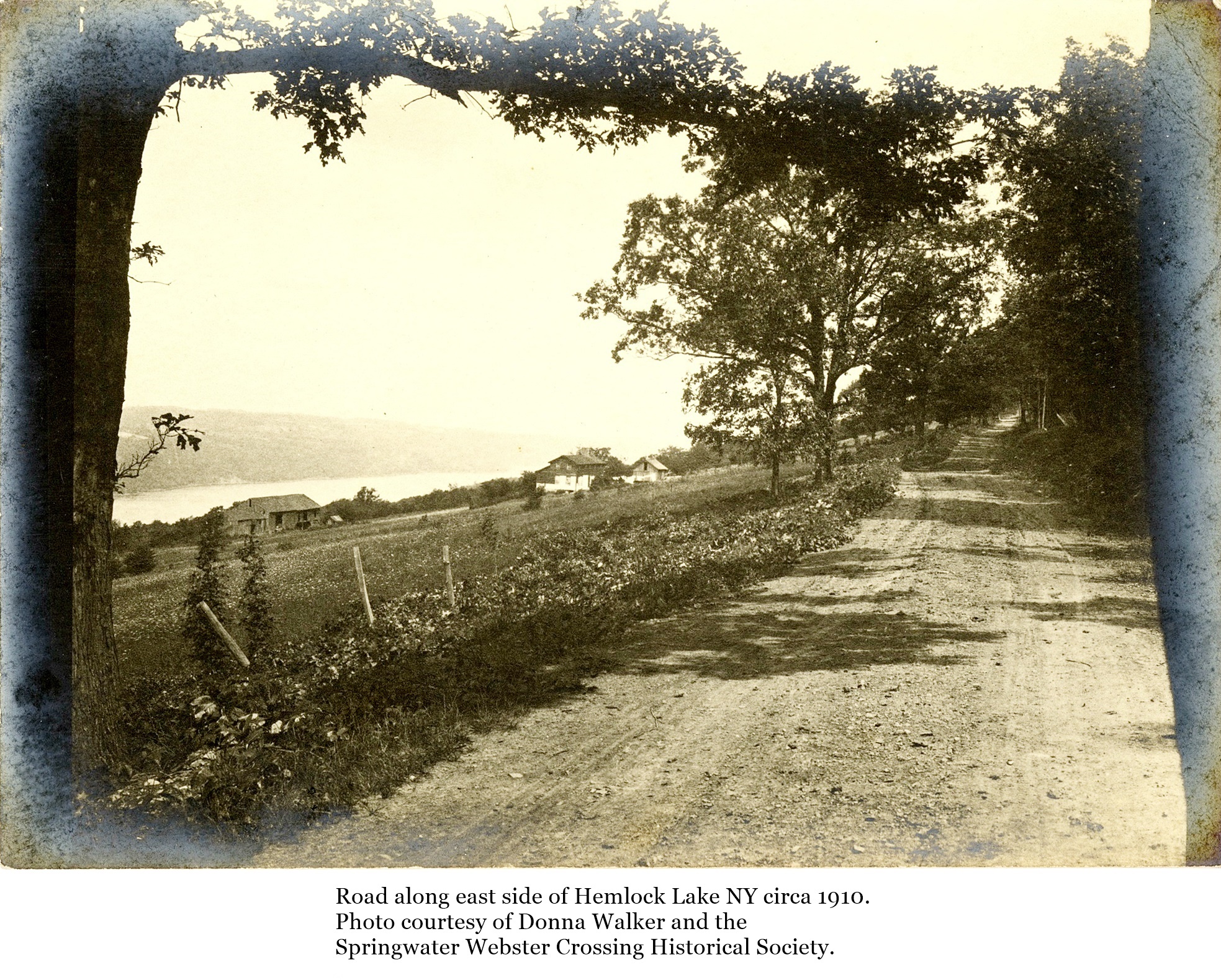
A view along the road on the east side of Hemlock Lake NY circa 1910. Photo courtesy of Donna Walker and the Springwater Webster Crossing Historical Society. Click the image to enlarge. |
|
6 |
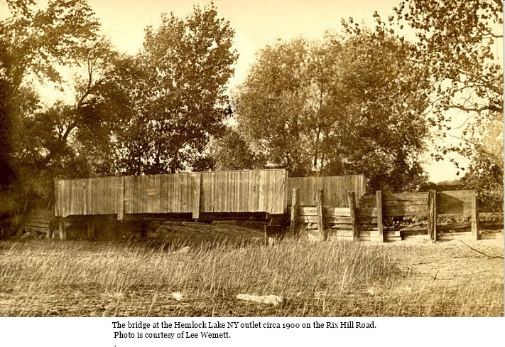
A photo of the wooden bridge at the Hemlock Lake NY outlet on Rix Hill road circa 1900. This photo is courtesy of Lee Wemett. Click the image to enlarge. |
|
7 |
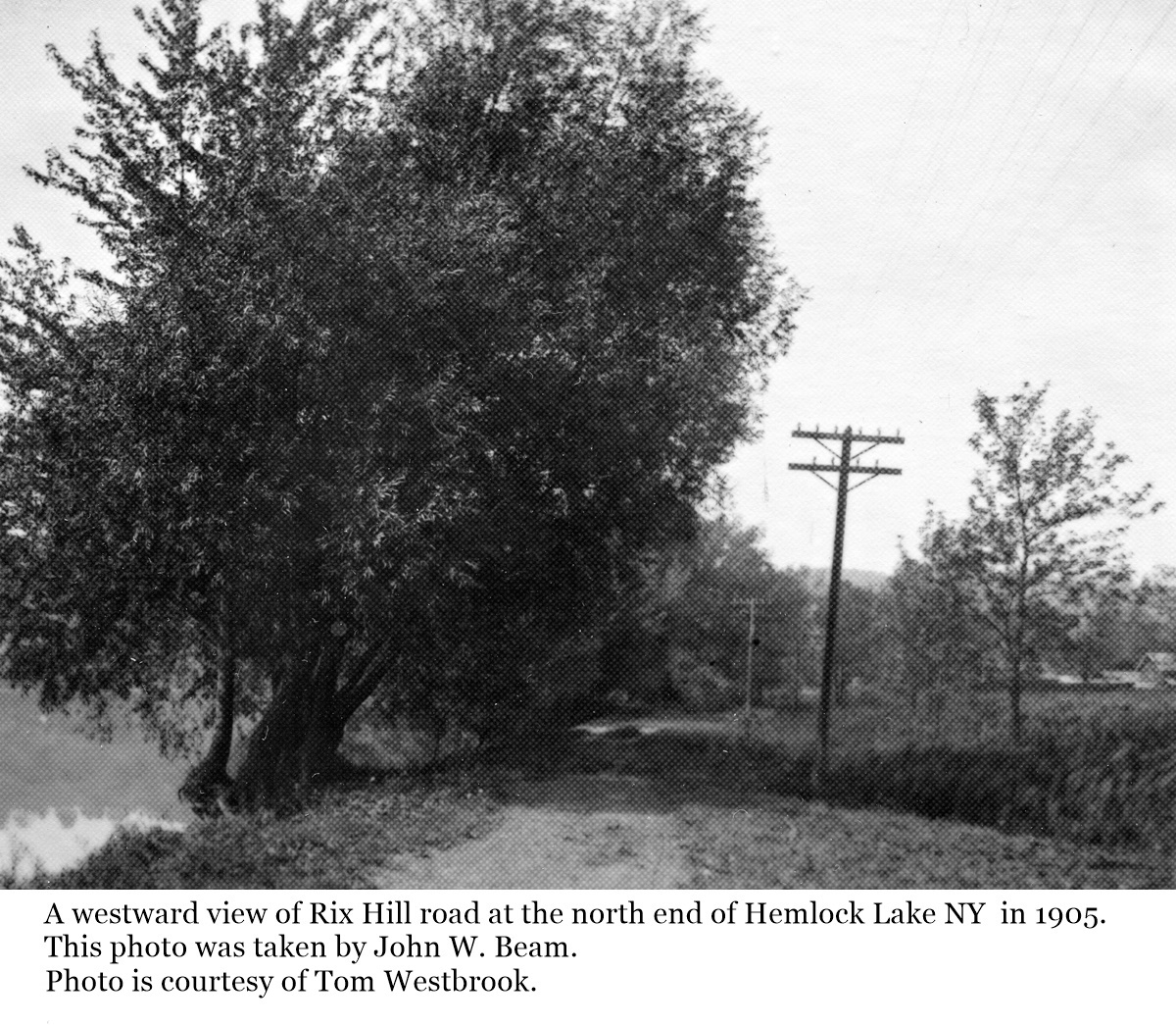
A westward looking view along Rix Hill road at the north end of Hemlock Lake NY in 1905. This photo was taken by John W. Beam who ran a milling business in near by Glenville. This photo is courtesy of Tom Westbrook. Click the image to enlarge. |
|
8 |
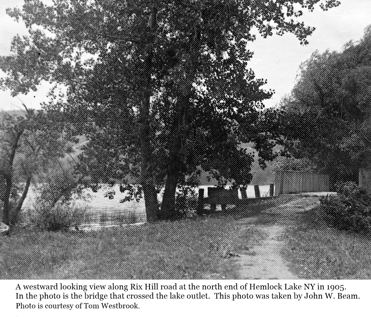
A westward looking view along Rix Hill road at the north end of Hemlock Lake NY in 1905. In the photo is the bridge that was over the lake outlet. This photo was taken by John W. Beam who ran a milling business in near by Glenville. This photo is courtesy of Tom Westbrook. Click the image to enlarge. |
|
9 |
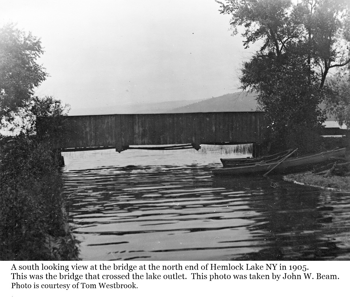
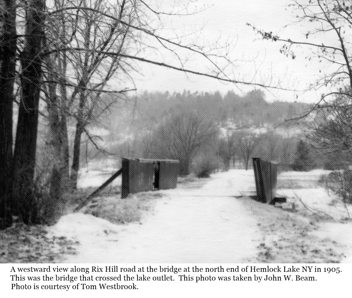
A south looking view at the bridge at the north end of Hemlock Lake NY in 1905. This was the bridge that crossed the lake outlet. This photo was taken by John W. Beam who ran a milling business in near by Glenville. This photo is courtesy of Tom Westbrook. Click the image to enlarge. |
|
10 |
A westward looking view along Rix Hill road at the north end of Hemlock Lake NY in 1905. Click the image to enlarge. This photo is courtesy of Tom Westbrook. From the Livonia Gazette, 16 August 1929 Removal of Old Bridge at Foot of Hemlock Lake Action has been taken to eliminate the bridge in the town of Livonia at the foot of Hemlock lake, which is an old iron structure of fifty-foot span which would cost from $5,000 to $7,000 to replace. The plan is to secure right of way from the City of Rochester for the relocation of the road to permit doing away with the old bridge. It is estimated that the cost of the change will approximate $1,000.
|
|
11 |
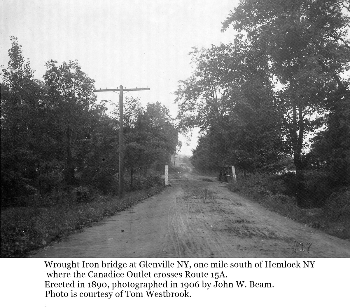
The wrought iron bridge at Glenville NY, one mile south of Hemlock NY where the Canadice Outlet crosses Route 15A. The bridge was erected in 1890, photographed in 1906 by John W. Beam. Hemlock Lake can just be seen through the trees on the right. This photo is courtesy of Tom Westbrook. Click the image to enlarge. |
|
12 |
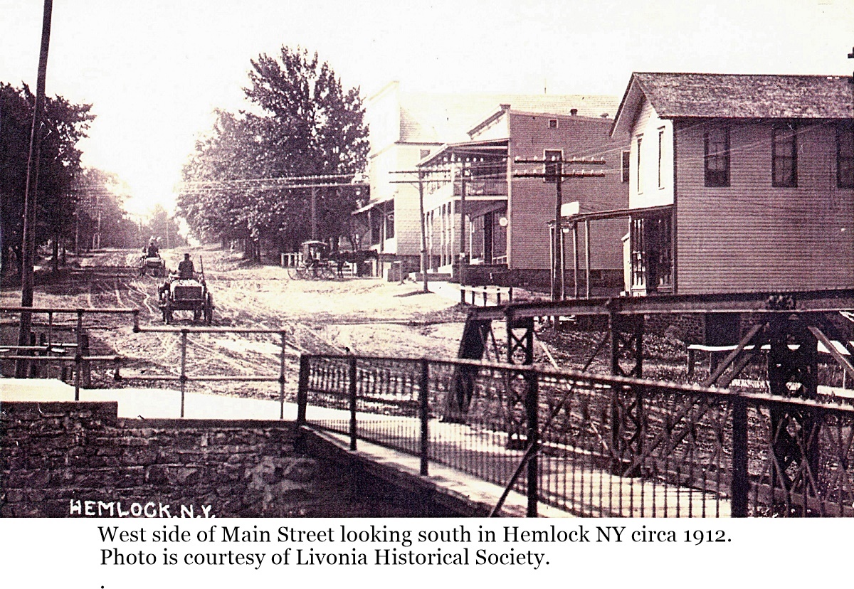
The wrought iron bridge on Main Street in Hemlock NY circa 1912. The view is looking south from the north side of the mill stream in the center of the village. When this bridge was replaced, some of the hand railings from the bridge were used on buildings in the village. One of the railings is on display across the street from the Agway Mill building. This photo is courtesy of the Livonia Historical Society. Click the image to enlarge. |
|
13 |
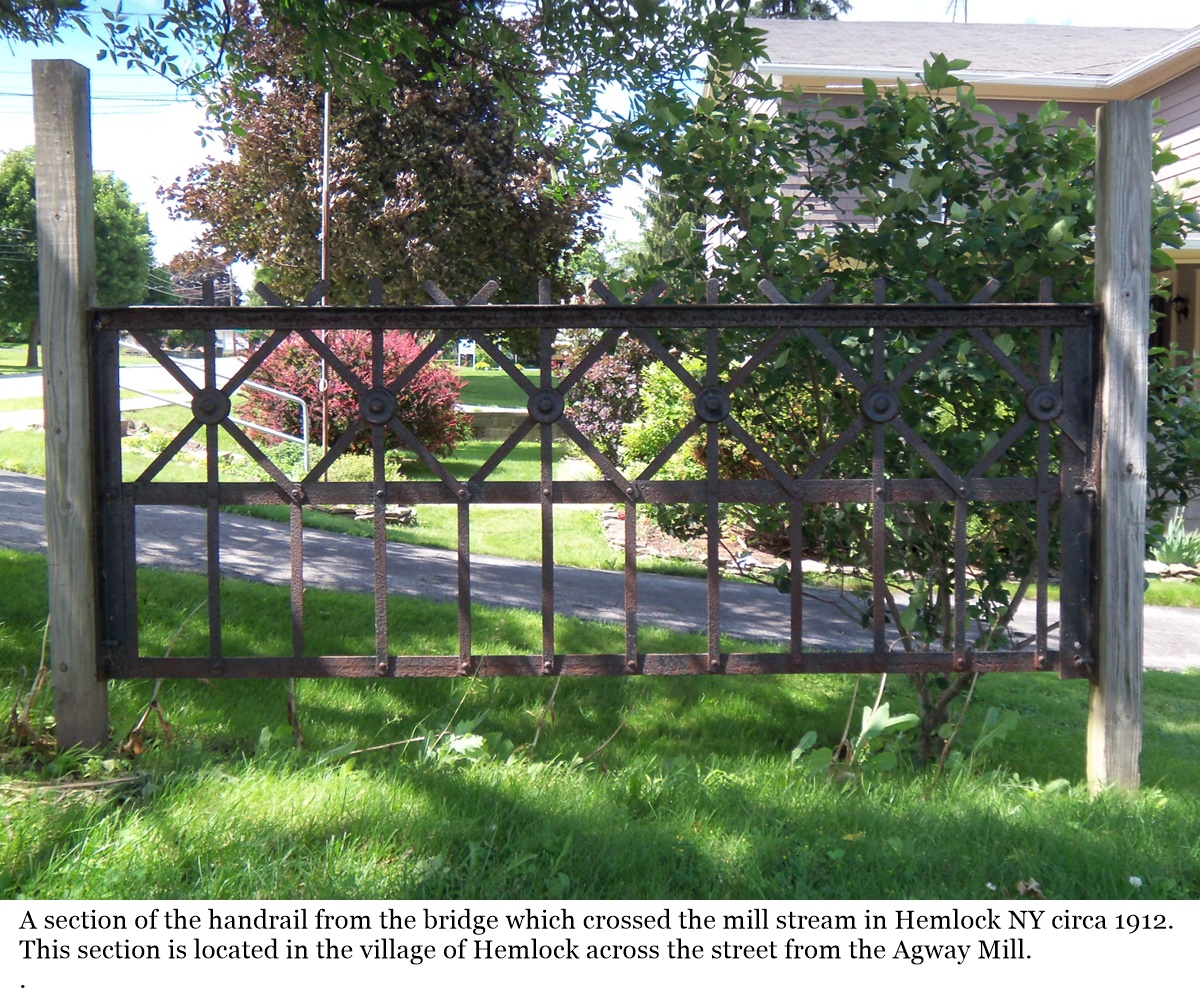
A section of the handrail from the wrought iron bridge that was in Hemlock NY circa 1912. When the bridge was replaced, some of the sections were used as handrails on some of the buildings in the village. One of the railings is on display across the street from the Agway Mill building at the center of the village. Click the image to enlarge. |
|
Jacksonville |
|
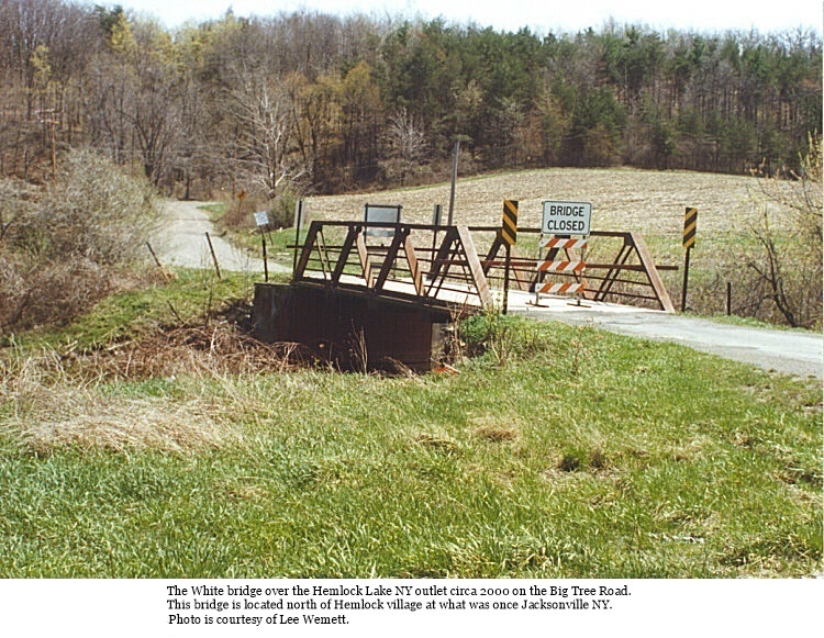
14 |
A photo of the White bridge over the Hemlock Lake NY outlet on Big Tree road circa 2000. This bridge is located north of the Hemlock village where the village of Jacksonville once was. This photo is courtesy of Lee Wemett. Click the image to enlarge. |
|
Springwater |
|
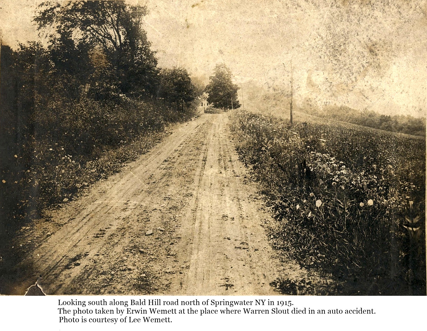
15 |
A photo of Bald Hill road along the east side of Hemlock Lake NY in 1915. The photo was taken just north of Springwater NY looking south at the place where Warren Slout died in an auto accident. This photo was taken by Erwin Wemett on the day of the accident, 28 July 1915. This copy courtesy of Lee Wemett. Click the image to enlarge. |
|
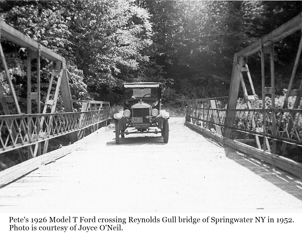
16 |
A photo of Pete’s 1926 Model T Ford on the Reynolds Gull bridge in Springwater NY in 1952. The wooden “Covered Bridge” fell into the gorge in 1902 and was replaced by this wrought iron bridge. The identity of Pete is unknown. This photo is courtesy of Joyce O’Neil. Click the image to enlarge. |
|
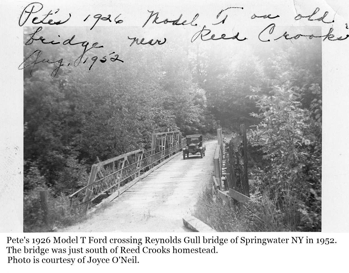
17 |
A photo of Pete’s 1926 Model T Ford on the Reynolds Gull bridge in Springwater NY in 1952. The wooden “Covered Bridge” fell into the gorge in 1902 and was replaced by this wrought iron bridge. The bridge was just south of where Reed Crooks home was. The identity of Pete is unknown. This photo is courtesy of Joyce O’Neil. Click the image to enlarge. |
|
Websters Crossing |
|
Images of Old Roads and Bridges of Websters Crossing coming soon. |
|
|
|